CSO Notification Program
To help communicate with the public about local water quality, MSD maintains a CSO Notification Program which includes signage and a CSO Activity Map.
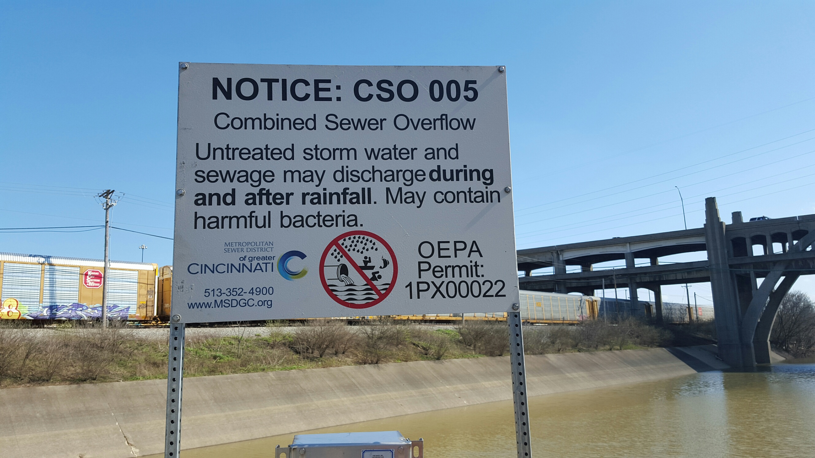
A CSO is a combined sewer overflow. Much of Hamilton County is served by combined sewers, which carry both wastewater from homes and businesses and stormwater runoff from roads, buildings, and the ground. During heavy rains, combined sewers can fill up with too much stormwater and overflow into local rivers and streams. MSD has invested billions of dollars to significantly reduce the overflows, but work continues to address this problem. LEARN ABOUT MSD'S WET WEATHER PROGRAM.
STAY SAFE: AVOID CONTACT WITH STREAMS AFTER RAINSTORMS FOR 72 HOURS
The public should avoid contact with impacted streams or rivers for at least 72 hours after a rainfall or after water levels have returned to normal. This includes refraining from participating in activities such as boating, wading, fishing, and swimming.
The public should always exercise caution when in and around local waterways, as conditions can change quickly! Do not rely solely on signs or the CSO Activity Map to keep yourself, your family, and your pets safe.
SIGNAGE AT CSO OUTFALLS
To alert the public to the potential for CSOs, signs are posted at each CSO discharge location along the Ohio River, Mill Creek, Little Miami River, Muddy Creek and their tributaries.
CSO ACTIVITY MAP
Any CSO outfall that is suspected to be actively discharging or is suspected to have discharged in the last 72 hours is shown on the map below. Data is updated once every hour. Please remember to refresh your browser frequently to see the most up-to-date information.
Map Legend:
- Currently Active: Remote monitoring indicates a CSO may be occurring at this location.
- Recently Active: Remote monitoring indicates a CSO may have occurred within the previous 72 hours, but water levels have returned to a normal elevation.
- Flooded: The local creek or river level is elevated and may be entering the combined sewer system at this location
- Data Unavailable: The CSO outfall was in an active or flooded state within the last 72 hours, but data is no longer accessible, so the status is unknown.
NOTE: MSD maintains an advanced system of sensors that monitor the conditions at all CSO outfalls. Data is available once every hour, so while the CSO Activity Map isn’t a “live” video feed, it shows the conditions in near real-time. While the system is highly reliable, there still can be false alerts. MSD reviews this data daily and reports all confirmed overflows to the Ohio EPA within 24 hours.